
23 Bike Trails In WASHINGTON (Calming, Enjoyable, & Scenic)
Washington is the most popular and populated state, with various unique places to visit and things to do.
Do you love bike riding, traveling long distances, and exploring various trails?
If you answer yes, this article will take you on a tour of the fantastic and challenging trails in Washington State.
Washington is home to bike trails full of beauty, history, and adventure.
This state was named the United Nations’ Number one bike-friendly state.
After scrolling down this page, you will know that 1000 miles of trails are hidden deep, pass through dense forests, and can be used as alternative transportation hubs.
Have you started reading this?
Bike Trails in Camas, Washington
1. Lacamas Park Trail
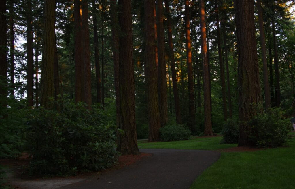
It is a diversified natural area of 312 acres, giving a wild feel, and consists of an extensive network of trails, gorgeous lakes, green meadows, and forested regions hiding waterfalls.
You’ll enjoy beautiful scenery by strolling across these paths and feel blessed.
As you hike, you’ll see an interconnected network of trails that provides an opportunity for adventure to bikers of all skills level.
Depending on the difficulty and distance, the trails are divided into
- Lake to Lake Trail Loop of 4.6 miles with moderate difficulty.
- Round Lake and Camas Potholes of 3.8 miles have moderate difficulty.
- Woodburn Falls and Round Lake of 2.9 miles with easy difficulty.
You can easily access Round Lake, Woodburn Falls, Pothole Falls, and Lacamas Creek on your tour.
This trail features green landscapes, terrain, forested sections, waterfalls, and massive rocks, offering beautiful sceneries and wild species.
You can also extend your hike by using side trails.
Address: 3344 NE Everett Street, Camas, Washington 98607, United States
Related: Best bike trails in Illinois
2. Fallen Leaf Lake Hike
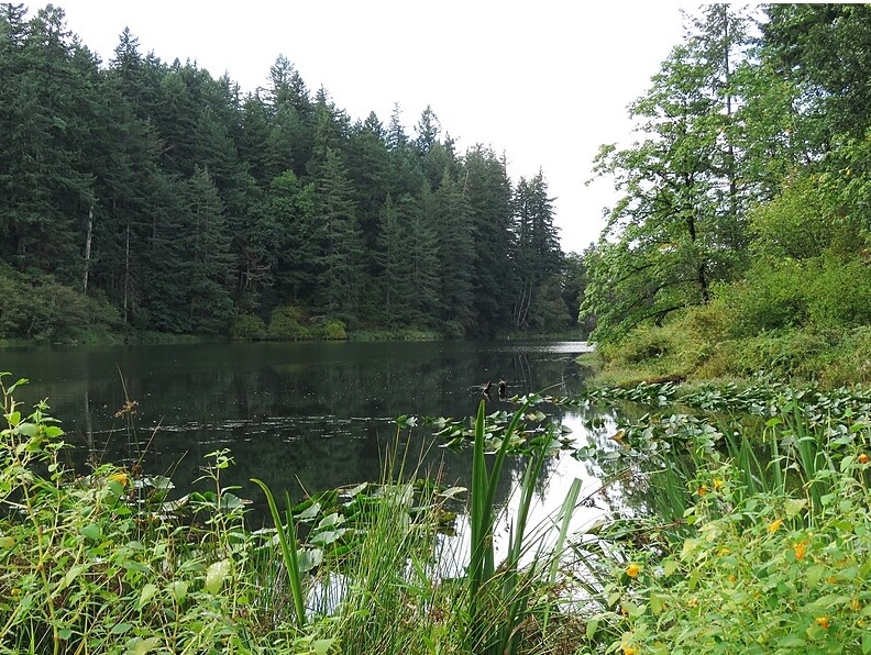
It is an area of 55 acres, including an entire hiking trail of 4.1 miles around the dead lake, and it is renamed Fallen Leaf Lake.
This trail gains an elevation of 600 ft with its highest point of 455 ft, offering an easy to moderate difficulty route for bikers of all ages.
It features a confusing network of trails extending through the forest that led it to the left at a pet waste dispenser and designed for mountain bikers.
You’ll see choked woods with ivy and holly rough bushes, soft fields, big-leaf maples, lakes, large maple trees, and blackberry vines here.
According to visitors, it is famous for unknown drownings, and they claim that aquatic plants tangled them and dragged them into the depths.
You’d also experience an old road bed located at Douglas-fir, cedar hemlock, and Oregon grape with an underwood of sword fern providing you with its beautiful glimpses.
On your visit, be careful of such kinds of lakes.
Address: 2911 NE Everett Street, Camas, Washington 98607, United States
Bike Trails in Tacoma, Washington
1. Swan Creek Park (Mountain Biking Trails)
This park occupies 373 acres of area, in which Metro Parks Tacoma (MPT) owns 276 acres and Pierce County owns 97.
Swan Creek Park is famous for its mountain biking trails and consists of 25 tracks of various difficulties and styles covering 3 miles of distance.
It offers a variety of loops and freeride lines of fantastic shape, providing fun and excitement to the biker.
Depending on the difficulty level, the trail is distributed into five different loops, which are
- Hustle & Flow is of beginner difficulty and is the main cross-country loop of 1.8 miles.
- Breaking Bad is of intermediate difficulty and is an expert-rated downhill of .31 miles.
- Feedback (.15 miles), Light Rail (.16 miles), and Murphy’s Law (.62 miles) are of intermediate difficulty.
It also features a longer, flowy, freeride line with rollers and small jumps.
TNT Expert is its largest freeride line, rated for professional expert riders with mandatory but smaller gaps.
If you plan a ride, it’s better to go swiftly after rainfall.
Address: 3997 E Roosevelt Avenue, Tacoma, Washington 98404, United States
Read more: Breathtaking bike trails in Florida
2. Titlow Park Trail
In 1923, Titlow Park was known for its luxury stay and Hotel Hesperides, which was remodeled during a WPA project to become a public park.
It is now famous for its green natural trails, amenities, and expansive beach.
Located on Puget Sound at the base of 6th Avenue and features a tennis court, playlands, spray grounds, picnic areas, and an estuary lagoon.
It offers two trails to its visitors and bike riders.
- The Hidden Beach Loop of 1.3 miles skirts the lagoon, stretches through the forest and terminates along the beach.
- Lagoon Loop surrounds the lagoon’s edge and terminates back at the parking area.
In addition to biking trails, you can also get its lodge for various events such as weddings, parties, and other mega-events.
Visit it if you want a solo and short bike hike.
Address: 8425 6th, Tacoma, Washington 98404, United States
Related: Stunning bike trails in NY
3. Pipeline Trail
This is a trail of 4.3 miles constructed in three phases from 2012 to 2020, and it is reported that Pierce County is working on its extension.
It runs from District Dome to the County lines, including 2.3 miles of separated paved trail with 2 miles of street facilities for bikes and connected sidewalks.
The name originated from running above the underground water pipeline owned by Tacoma Water.
It features a self-guided tree tour of 13 trees planted across the trail segment.
This trail collaborates with the City of Tacoma, Tacoma Water, and Pierce County.
You’d experience excellent coloring pages of art and science that provide a learning opportunity for kids.
If you want a safe walking and biking route, try this trail.
Address: 72nd St E and 94th Avenue E, Tacoma, Washington 98404, United States
4. Puget Creek Natural Area
This is a small urban creek of 66 acres with a trail of walkers, bikers, and cyclists, and it runs across one of the three salmon-bearing streams.
It features an elevation gain of 200 ft with a grade hitting 10%.
The trail is covered chiefly with meshy bushes and lined with tall trees.
Its terminal portion ends near Ruston Path and provides a pleasant wooded diversion for visiting the waterfront.
This trail was named for Peter Puget due to his exploration and mapping of Puget Sound.
Established in 1985, it provides a shelter for Chum, Coho salmon, and Cutthroat trout.
Plans are being constructed to re-renovate this trail and re-establish the regular runs of salmon species and sea-run coastal cutthroat trout.
Have you visited Puget Creek Natural Area before?
Address: N Lawrence Street & Alder Way, Tacoma, Washington 98407, United States
Read more: Scenic bike trails in Texas
Bike Trails in Kent, Washington
1. Soos Creek Trail

This 5.9-mile paved trail spanning through wetlands and green lands makes it the best track for expert bikers and horseback riders.
It connects to the Lake Youngs Trail, making a corridor near the trail’s midpoint at SE 216th Street, allowing bikers to extend their ride to 9 miles (unpaved).
This trail starts from scenic Lake Meridian in the south, includes a hilly course northward, and ultimately terminates at Meeker Middle School.
It passes through deeply wooded forest occupying the eastern edge of the Seattle area of Kent.
When riding a bike, you’d enjoy this paved trail while passing through the dense forests, vast green areas, and especially marshlands.
It features a soft trail for equestrians, a natural setting for bicycles, bikes, and horse rides, and provides a pleasant feeling.
Will you like to extend your ride through SE 216th St corridor?
Address: 5200-25298 SE 30th Street, Kent, Washington 98030, United States
2. 277th Street Corridor Trail
Also known as 277th Recreational Corridor is a 3.5 miles (3.7 km) out-and-back fully paved trail, and it is rated as an easy route and takes 1 hour to complete.
It gains an elevation of 130 m from west to east with a maximum height of 420 m.
Featured by two segments, it’s like a roller coaster in the western section, which climbs up and over the railroad tracks having a width of 8 ft.
A side trail is also present, connecting this segment to Interurban Trail.
The eastern segment is a narrow trail of 4 ft climbing the valley wall, switchback in multiple curves, and ascending through the woods.
At the top hill, it becomes a sidewalk, and you’ll see frequent signs here to direct bikes and pedestrians.
If you are hiking, then reach the top to enhance your experience.
Address: 27459 108th Avenue SE, Kent, Washington 98030, United States
3. Green River Trail
Its 19.9 miles (31.5 km) one-way paved trail offers a great perspective of the city with 900 ft elevation and the highest point of 82 ft.
Green River Trail stretches across the scenic North Green River from Kent to Cecil Moses Park and often crosses the Duwamish River.
It is a covered trail that starts at the spinning basin allowing large ships to go back downstream, and it crosses a bridge by a cultural site known as North Wind’s Weir.
While riding the bike, it spans Tukwila’s Allentown region, where you can see its Community Center across the river.
You can find a direct corridor to the Interurban trail in the north near Fort Dent Park and at its southern end near Foster Park.
Overall, the trail covers a variety of wetlands, parks, communities, beautiful landscapes, river views, and industrial and rural spots, making it the best destination for a recreational picnic.
Designs are under construction for its development.
Address: Cecil Moses Memorial Park: 1800 S 277th Street, Kent, Washington 98032, United States
Bike Trails in Renton, Washington
1. Springbrook Trail
It is a 2.3 miles trail providing a beautiful spot for both walkers and bikers, and it is centrally in an urban area surrounded by nature.
This trail has two segments, the north starting in Black River Riparian Forest spanning along Black River and terminating at Oakes Dale Avenue.
While another segment initiates at SW 27th Street and connects you from Oakes Dale Avenue to the start of the street wall.
You’d access ¼ miles long boardwalk area here bubbling over the green and rough mashes, and you can walk your bikes on it.
Fuelled with thick vegetation and covering trees, it provides an excellent spot to capture and see a variety of tree and water-loving birds.
The covering of trees disappears at the edge of the wetland, but the trail continues with a cover of tiny natural shades.
It is the best natural place for bike riders and pedestrians.
Address: 12202 SE Petrovitsky Road, Renton, Washington 98058, United States
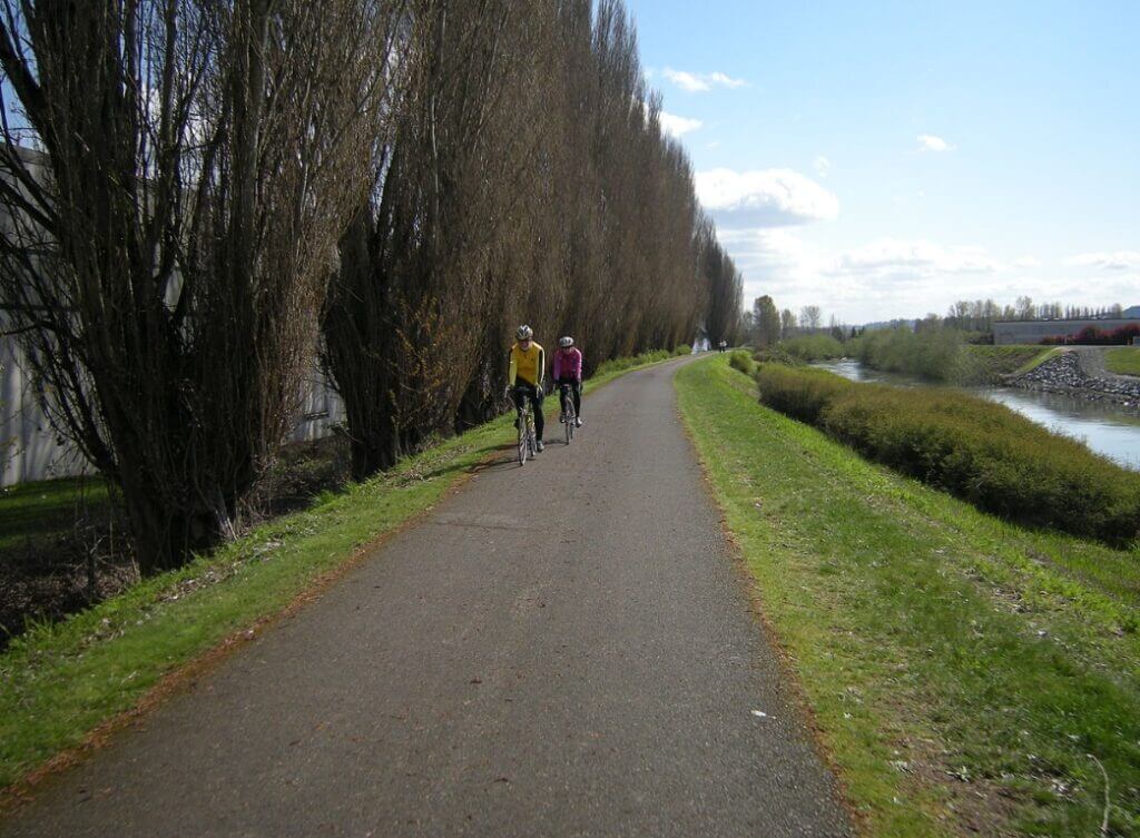
2. Cedar River Trail
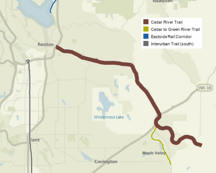
This 17.3 miles (27.8 km) partially paved trail starts at Renton’s historic downtown and follows the Pacific Railroad corridor on a straight, sprawling Seattle metro area and into the countryside.
It rolls across the Cedar River to Landsburg Park, connects Renton to Maple Valley, and here at 12.3 miles, links to Cedar to Green River Trail (off-road paved).
The surface looks like crushed gravel representing a winding course through a forested scenery and terminates about 5 miles away in Landsburg.
You can get access to downtown Renton, Maplewood Golf Course, Lake Washington, Cedar River and Grove Park, and Maple Valley offering you a colorful spectacle blessing view.
It is famous for bicyclists, bikers, and skaters, providing them with a recreational and fantastic spot to show their skills along with non-motorized commuting facilities.
A bridge parallel to State Route 169 is now open for pedestrians, bikers, and equestrian traffic.
Address: 1060 Nishiwaki Lane, Renton, WA 98057, USA
3. Lake Youngs Park
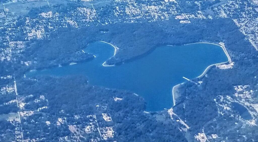
It’s a 9.3 miles gravel trail surrounding the Lake Youngs Reservoir, and it gains a maximum elevation of 900 ft, making it suitable for jogging and mountain bike ride.
Lake Youngs trail follows through various suburban and rural landscapes and lush meadows, and rolls across hilly terrain.
The entire track is soft surface gravel, with one section passing along the fence, and protects its reservoir.
While the other portion parallels a city street, most of the path is flat with one short and sharp section.
It is primarily dual-track, along with some single-track sections.
The track’s width varies between the single lane and narrow footpath.
You can get access to multiple hiking opportunities, including Spring Lake.
The trail features shady trees, a neighborhood trail, and blooming flowers, providing a beautiful glimpse of Lake Youngs.
There are several no-shooting signs present to protect its deer population.
Address: 19801 Lake Youngs Way Southeast, Renton, WA 98058, United States
4. Eastside Rail Corridor
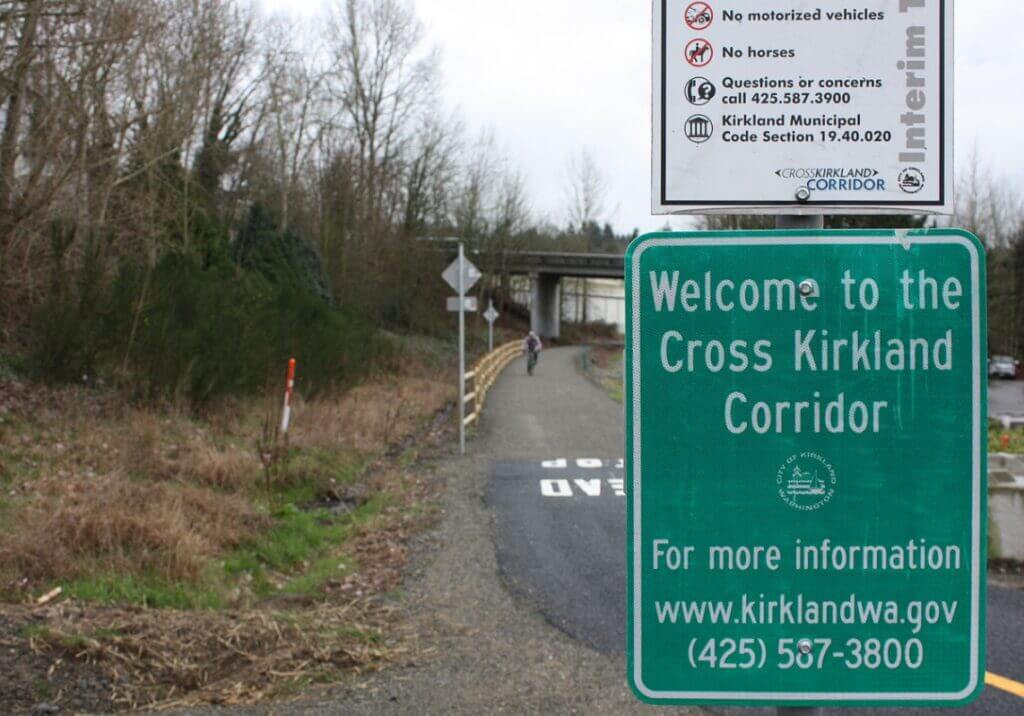
Officially Eastrail is an uninterrupted rail trail of 42 miles used for hiking, biking, and cycling, with the highest point of 200 ft and lowest point of 20 ft.
The 5.75 miles trail was opened in 2015, consisting of a Kirkland portion for pedestrians and bicyclists, with gravel surfacing.
It extends from G. C. Memorial Beach Park in Renton, Bellevue in the north, to Woodinville, and ultimately ends at the city of Snohomish in Snohomish County.
On your journey, you can access Memorial Beach Park and enjoy a delicious lunch, swimming places, and a vast relaxing playground.
It also connects to Cedar River Trail, located near its southern end.
The trail is heavily lined with trees, and you’ll also witness glimpses of the lake.
At the end of your journey, you can access Bellevue’s Newcastle Beach Park extending your biking on natural trails.
Address: 1201 Lake WA Boulevard North, Renton, WA 98056, United States
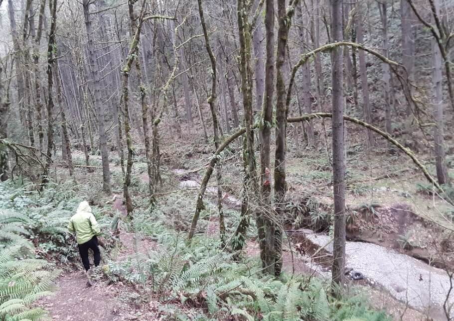
5. May Creek Trail
It is a historical route of 3.5 miles, roundtrip with an elevation point of 585 ft, highest point of 398 ft, and located between Renton and Newcastle.
May Creek Trail follows a historical route of the Seattle-Walla Walla Railroad, and now the old railroad is opened as a pleasant woody trail along with a deep forested valley.
After exploring, you’ll get a connection to Lake Washington with Cougar Mountain Regional Wildland Park with hiking along scenic May Creek.
The trail crosses the valley at old railroad grade through a long trestle bridge.
According to expert riders, it is considered a moderately complex trail rated for bikers of all skill levels.
You can also access the Highlands development by crossing Coal Creek Parkway to enjoy a network of greenbelt tracks.
After 0.8 miles of track, you can access Sylvan Creek’s small ravine and a horse paddock and reenters the forest.
Address: 195 Cedar Avenue South, Renton, Washington 98057, United States
Bike Trails in Spokane, Eastern Washington
1. Mount Spokane State Park
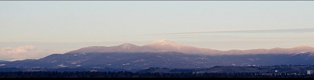
It’s a hub for adventures providing you with over 100 miles of trails hidden deep in heavily forested Selkirk’s Mountains and offering you panoramic views.
The mount features elevations of 3200 ft to 5774 ft and provides an extensive network of trails for hiking, biking, pedestrians, and horseback riding.
You’ll witness gorgeous cedar forests, meadows filled with fresh flowers, and the high alpine across your journey.
The tracks are rated from easy to challenging to ensure that bikers of all skill levels can experience and enjoy their ways.
Mount Kit Carson Trail, Three Peaks Loop, and Burping Brook – Smith Gap Loop are its top three famous trails for experts.
You can access a rolling dual track in the Nordic area with stunning views of Idaho and Montana.
If you consider yourself an expert, get a challenging ride to the summit of Mt. Spokane using 140, which is very difficult.
Be careful because Moose can be present, so keep your eyes open.
Address: 26107 N Mt Spokane Park Dr, Washington 99021, United States
2. Palouse to Cascades State Park Trail
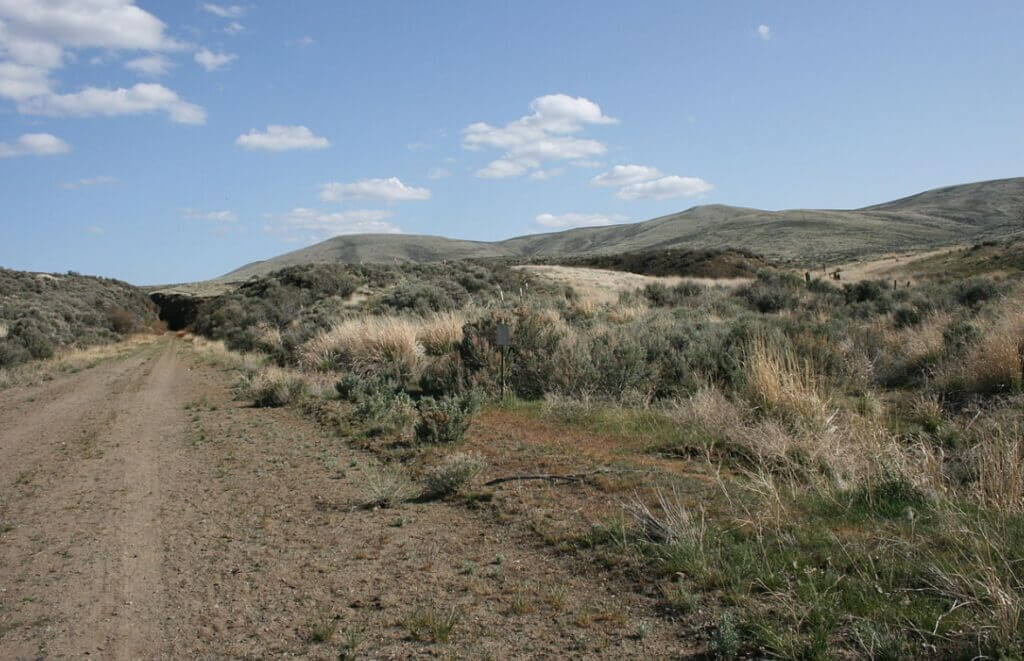
This is the longest trail, 285 miles (459 km) covering two-thirds of the state, and connects Washington State to Washington D.C.
It was formerly called the John Wayne Pioneer Trail, the Iron Horse Trail, and was decommissioned in 1980.
Palouse to Cascades Trail was ranked as National Recreation Trail in 2002.
It begins from the Idaho border to Cascade Range’s western slope.
On your riding journey, you’ll see many tunnels, cascading streams, beautiful lakes, woody forests, gravel and dirt trails, and stunning views.
It connects remote and eastern lands with heavily forested mountains of the west and follows the railway road network of Chicago, Milwaukee, St. Paul, and the Pacific Railroad.
This trail has six tunnels, along with the longest trail tunnel in the world known as Snoqualmie Tunnel; others are Boylston, Thorp, Picnic Area, Easton, and Whittier.
If life gives you a chance, do visit this trail.
Address: East Lincoln Road, Spokane Valley, WA 99027, United States
3. Spokane River Centennial State Park Trail
According to the data, it is a paved trail of 37 miles or 40 miles managed by Washington State Parks and used for recreational spots, walking, biking, and as alternate transportation.
The trail terminates at the Idaho border by extending via eastern Washington from Sontag Park in Nine Mile Falls.
It connects the cities, including Spokane, its beautiful Valley, Liberty Lake, and neighbored County, Idaho.
This trial is divided into three sections:
- Riverside represents the trail within Riverside State Park.
- Valley refers to the section east of Spokane (Spokane Valley).
- Urban area indicating path within the city of Spokane.
Rural-urban trail is most suitable for hardy hikers, expert bikers, and inline skaters, providing a delightful and insightful adventure.
You’ll witness bridges, trestles, large basalt formations, and historic downtown and will have a welcoming lunch.
Riverside Trail is famous for horseback riding and is horse-friendly.
You’ll get more than 40 historically significant sites on your hike.
Address: 10200 West Riverside Park Drive, Nine Mile Falls, WA 99026, United States
Bike Trails in Seattle, Washington
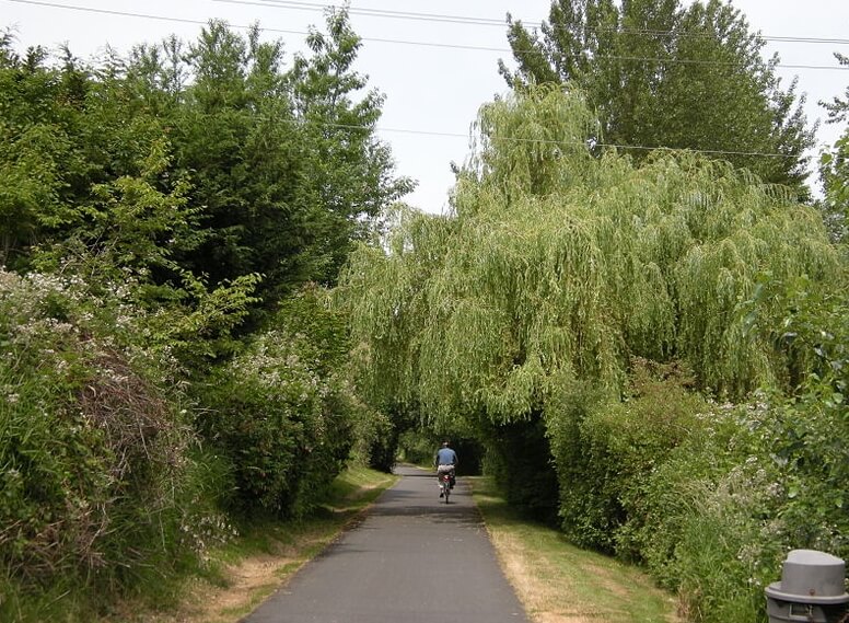
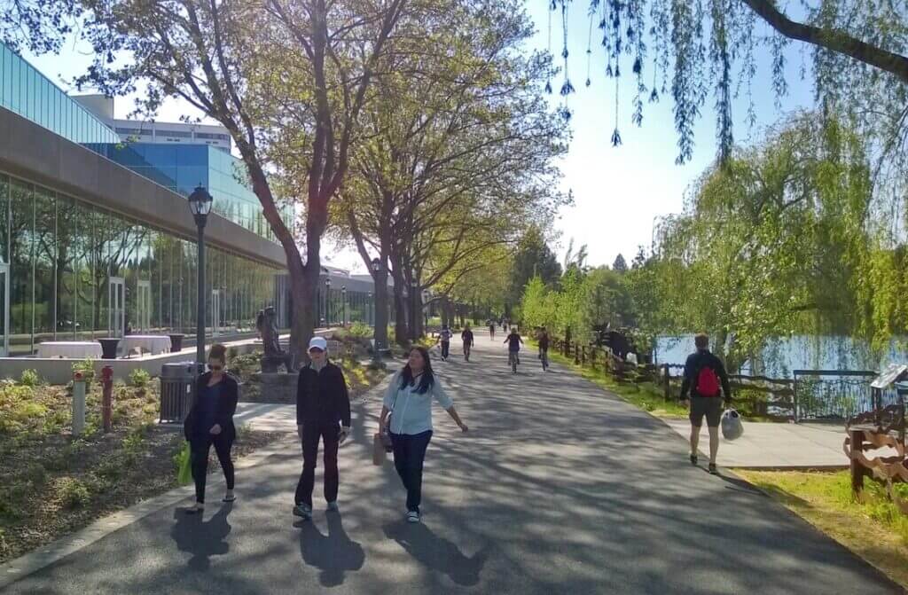
1. Burke-Gilman Trail
This paved trail of 27 miles (43 km) spans from Seattle to Eastern Railway and is a part of King County’s trail network.
It is officially a part of 90 miles of signed and 175 miles of trails in Seattle and King County trails, respectively.
From Puget Sound at the Golden Gardens Park, wrapping around Lake Washington and ending in Bothell, it leads you to Ballard and Fremont neighborhoods.
It is a famous multi-use recreational track for bikers of all skill levels, walkers, runners, commuters, and skaters.
On your tour, you’ll observe the University of Washington and the gorgeous and secluded path of fir, maple, and dogwood trees in the U District.
You’ll witness the city of Lake Forest Park featuring a fun lakefront, and at the end, you will get access to Blythe Park, where you can relax at its playgrounds and picnic areas.
The entire route is called the Locks-to-Lakes Corridor, and according to reports, it will be fully paved by the end of 2023.
Address: 8498 Seaview Place Northwest, Seattle, Washington 98117, United States
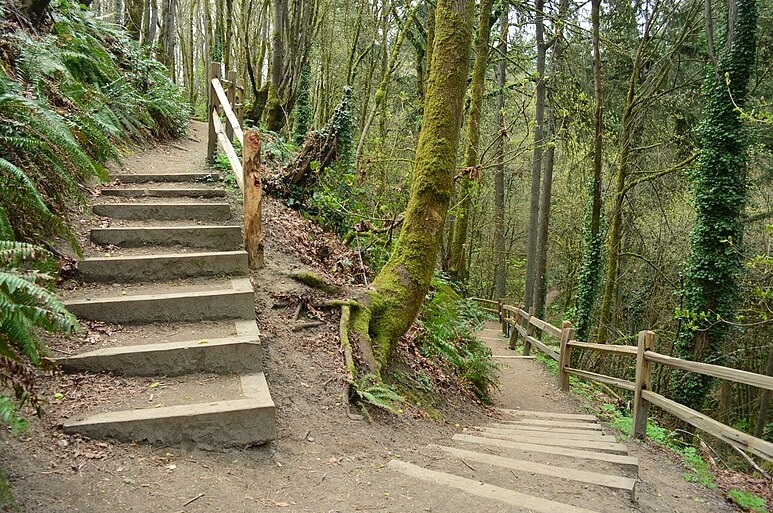
2. Interlaken Park Trail
This park consists of an area of 51.7 acres, including 1.6 miles loop hiking trail suitable for walking and biking for all skills level.
It is a route of easy level featuring an elevation gain of 200 ft with the highest point of 325 ft and takes 30 minutes to complete.
At 600 ft, the trail leaves the road, leading uphill to your left, and ultimately terminates at a small creek.
Interlaken Trail is an extensively wooded hillside track and a broad paved trail from its trailhead.
On your uphill hike, you’ll see attractive picturesque stairs that offer beautiful scenery to the rider.
After covering a short mile from the road, you’ll get a 175 ft elevation and reach a high point at the edge of E Galer St and 19th Ave E.
You may see a few fresh flowers in season, and snow is rarely here.
Address: 2451 Delmar Dr. E, Seattle, Washington 98102, United States
3. I-5 Colonnade MTB Park
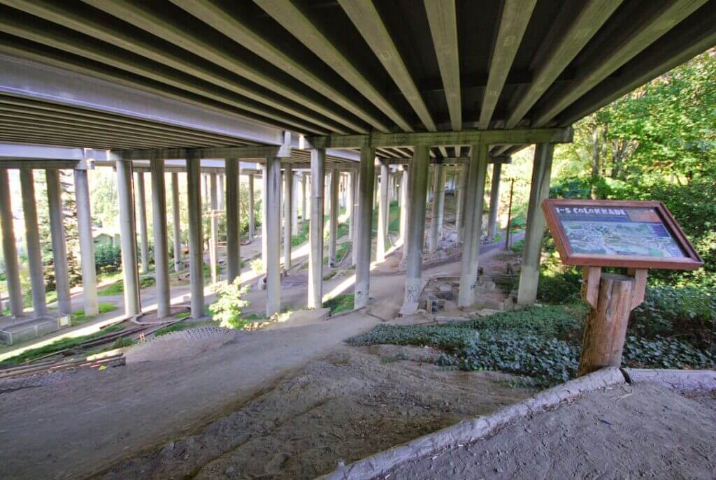
This is a most famous of its kind mountain skills park occupying roughly 2 acres out of 7.5 acres of total park and attracting euthenics bikers.
It was designed in 2005 by a Colonnade architect and spread from south of E. Howe St to E. Garfield St in between Lakeview Boulevard E and Franklin Avenue.
This trail offers beginner bikers a variety of learning skills and techniques, including an interpretive building area, a Fisher Line, a pump track, and an upper practice area.
It has two opening phases, with the first trail now called Limestone Loop in 2007 and many advanced trails opened in 2008.
Trails for expert riders include:
- A hilly switchback loop.
- Jumpy lines that feature K-lines.
- Nicks Kicks with an elevated structure area featuring Cyclone and the Octagon of Death.
A rocky jumble descent called the Waterfall and Freeride lines, such as The Offramp, Pips Hips, and Holy Chute, are present to test bikers’ skills.
Try this trail if you are a professional biker.
Address: 1701 Lakeview Boulevard East, Seattle, Washington 98102, United States
Bike Trails in Vancouver, Washington
1. Ellen Davis Trail
It’s an on and off-street trail of 4-6 miles distance, used for multipurpose including walking, jogging, and biking.
Having trailhead at Leverich Park, it connects the Discovery Loop trail with St. James Road.
This trail features woods, a valley, lush Creekside meadows, residential areas, and bridges.
Its name was derived from a local advocate, Ellen Davis (1905 – 1999), because he hiked 10 miles a week even at the last age of 94.
The initial 0.6 miles is paved and then becomes gravel.
With a couple of steep twists, most part is of a flat surface, making it a track of moderate difficulty for all bike riders.
It starts at Burnt Bridge Creek and passes through the Bonneville Power Administration gardens, crossing the lands of the JD Ross Substation Complex, and terminates in the Minnehaha neighborhood.
Address: Ellen Davis Trail, Vancouver, Washington 98663, United States
2. Burnt Bridge Creek Trail
This is an 8 miles hard-surfaced trail offering an opportunity to view the beautiful sites of Bridge Creek Greenway.
It covers a variety of landscapes, open grasslands, bridges, and extensive forested areas and is most suitable for walking, biking, and jogging.
Beginning at Stewart’s Glen in the Fruit Valley, it crosses I-5 and ultimately reaches Leverich Park.
It has different sections connecting to the Ellen Davis Trail and terminates at NE 97th Ave between NE 18th Street and NE 16th Street.
The Burnt Bridge Creek Trail includes Stewart’s Glen Trailhead, Leverich Park Trailhead, and Devine Road Trailhead.
You can also avail of restrooms at Stewart’s Glen and Devine Road Trailheads.
Most trail surfaces are asphalt, flat, and concrete, giving access to Leverich Park and Arnold Park.
You will notice the well-marked places that turn into sidewalks.
Address: 1617 N Devine Road, Vancouver, Washington 98661, United States
3. Frenchman’s Bar Trail
Starting from Vancouver Lake and terminating at Frenchman’s Bar, it covers a total distance of 10.5 miles crossing forested areas, lakes, and bridges.
An 8 ft wide bike path passes through the farm fields and rustling cottonwoods, connecting two playgrounds, Vancouver Lake and Frenchman’s Park.
You can hike north on a paved trail covered with a leafy arbor, which terminates at a small plaza offering a blessing sight of the lake.
Along the gravel path, you’ll observe a beautiful venue for spring, including dense growth of snowberry, jewelweed, and trailing blackberry.
Under tall, stretching oaks, the path turns into gravel and features a beautiful picnic area for sitting.
After moving a few miles right, you’ll reach the willow and dogwood-lined banks of the lake.
Remember to see the artificial sand beach on its main lawn on your visit.
Address: 9612 Northwest Lower River Road, Vancouver, Washington 98660, United States